Sunday, August 29, 2010

Scenic Idaho


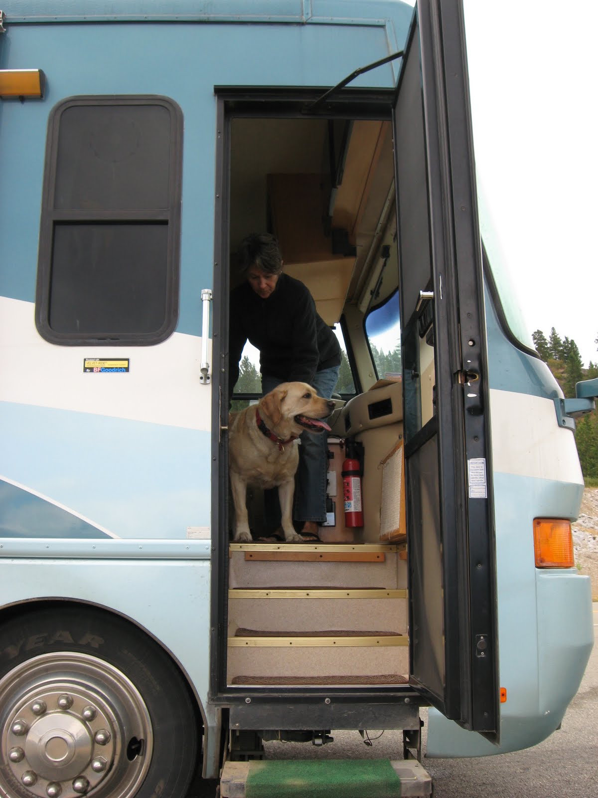
True to our word we did kick back in Coeur d’Alene and relax for a few days. Coeur d’Alene was really a big surprise as it is a beautiful little town at the top of Lake Coeur d’Alene which is the headwaters of the Spokane River. Our campground was right at the junction of the Lake and the River. There was a nice beach and Jake got to do a little swimming, yea! The town is really nice, now a resort community, but in its day the silver capital of the west. There are a lot of beautiful old home and buildings that are fully restored. We had two wonderful dinners on a floating restaurant next to our campground. Compared to the prices in Alaska and Canada, this place was a bargain and the food was great.

We made an appointment with the mobile wash man to wash the coach and he did a fantastic job. It looks as good as new. We took the Jeep through a touchless drive through car wash with the bikes still on the back and paid for the super deluxe wash. The bikes do not look too bad, but the Jeep really needs a good hand wash. Oh well we have a lot more towing to do, so it is going to get dirty again. We also had a chance to do many of the little things on the coach that we have put off while traveling. On the fourth day we were full of fuel and water, empty of waste and very refreshed. We decided to head out and do the scenic loops of Idaho’s highways.

Jake and Linda at the edge of the
largest wilderness areas in the lower 48. 
Our journey took us down US 95 to Lewiston and then across US 12, the Lewis and Clarke trail. The drive across US 12 is perhaps one of the prettiest drives that we have done. It follows the Clearwater River and then in Lowell turns up the Lochsa River through the Bitterroot Mountains. We stopped and camped in the national forest campground in Powell, ID. It is one of the nicest campgrounds that we have been in with huge sites that backed onto the Lochsa River and they even had electric, a rarity in the national forest.

Four wheeling in the Clearwater NF
There are a number of forest service road in the area, one being the Lolo Motorway built in the 30’s by the CCC. It was designed as a fire service road, but is open to the public. It runs along the spine of the mountain, is 100 miles long and follows the original Lolo trail used by Lewis and Clarke. Before tackling that in the Jeep, we decided to take a few easier trails. One leads up to a remote lake, eight miles back. All started well until we reached the portion that went up the mountain. The sign said one lane road with occasional turnouts. It was one lane all right but the turnouts were minimal. Linda was terrified that we would meet another vehicle and would have to back down. The road was also cut into a bench on the side of the mountain and the views down were spectacular or terrifying, depending on your perspective. After only two miles at a rather large turnout on a hairpin, the order was given to turn around and go very slowly back down. Linda checked at the ranger station about the Lolo Motorway and the lady said it was a lot like the road we did, except the drop off was on both sides. Any one want to buy a little used Jeep and a library of off roading books?


Linda at the Lochsa Lodge
A special treat for us was that the Lochsa Lodge was located at the entrance to the campgrounds. It is one of those do everything places that we encountered in the Yukon and Alaska; gas, store, lodging and a restaurant. The difference here was the place was beautiful, the food fantastic, the people ultra friendly and the prices very reasonable. If you are ever in the area, you have to stop here.


Linda and her pony, Sherman
OMG does that hurt!
Besides everything else, the Lochsa Lodge also offers horseback riding. Linda inquired and told them that her husband weighs 300 pounds, of which they said, no problem. They have one horse that is part Clydesdale and she would handle him. So the next thing you know we are signed up for a one-hour trail ride. When asked about our experience we said that we had ridden before in California, Australia and Tasmania, which is all-true. What we did not tell them was that it was all over 15 years ago and Mike was 70 pounds lighter. Our moment of truth was when we arrived at the corral. Mike’s horse, Bear, was huge and the first thing he thought was how am I going to get on this thing. Don, our guide, was very understanding and lowered the stirrup down as low as it would go. Mike put his foot in and lifted up. The problem now was that he could not get his other leg over the horse’s rump. The ever-helpful Don lifted Mike’s leg over the saddle. Now, not only was this horse tall it was big and round and it pulled Mike’s legs into a split position that they may have never been before. The pain was immediate. He equates it to straddling a wine barrel that is bouncing up and down. He should have quit right then, but no, Mr. Macho told Don that everything was fine. Linda of course, just bounced up on her steed, Sherman, a miniature pony, and was doing quit well. We are not sure what Mike was thinking, but off they went into the bush. Linda says the ride was wonderful. It was through the forest and along a path that Lewis and Clarke took when they first traversed this area. Mike’s only thought was when will this end. Don, our extra friendly guide turned our hour ride into an hour and a half at no extra charge. By the time we finished Mike’s legs were numb and his back was spasming. Don told Mike his legs might be a bit weak when he tried to get off. Mike told him that his legs we numb and he was going to need a lot of help. They did not have a crane available, so Don put down a few bales of hay and walked Mike to them. Again Don had to help get Mike’s leg over the horse’s rump and Mike slid down onto the bales of hay. After a short rest, he was able to crawl back to the Jeep on his own. We are happy to report that after only two days he is able to walk again. What were you thinking!!!


From Powell we crossed the Lolo pass over to Lolo and route US 93 which we took south to Challis, there turning onto Idaho route 75 which we took to Sun Valley, ID. That route follows the Salmon River most of the way and is for the most part was a very scenic drive.

Smoke from the fires in the Sawtooths
It is fire season here and we have seen a number of fires along the way. In Powell there was a lighting strike near the lake where we were Jeeping to and it started a small fire. The smoke turned the sun a dull red. Along 93, there were a number of fires and the smoke was pretty thick. Near Stanley, where we camped one night, the Ponderosa Pine Scenic Byway was closed for three days because of a fire. We passed by one tent camp set up to house firefighters. Our hats are off to these courageous men and women who spend weeks at a time out working in the bush to protect life and property from these devastating forest fires.

We are now just south of Sun Valley in a small very tight RV Park. But it does have cable TV and it is allowing us to watch the Steelers/Bronco game tonight. We have found that we are in Bronco Country and it is best for us to watch the game in our coach instead of a local bar. Go Steelers!

We hope that you all have had a wonderful, fire free week.

Take care, Love,
Linda, Jake and the Fat Man

Sunday, August 22, 2010

Alaskan Highway South

Last Monday we got the oil changed on both the coach and the Jeep. They were both done before noon and a heavy smoke enveloped Fairbanks from a nearby forest fire. We decided it was time that we started to head back south.

We decided to do something that we have never done before, and that was to drive the complete Alaskan Highway. We have driven all of the Alaskan Highway before, but never all in one segment. We had also never drove the highway south of Watson Lake, so it would all be a new experience. We originally had planned to go to Chicken and take the Top of the World Highway to Dawson City in the Klondike area of the Yukon, but there was more flooding and the highway was again closed. Going back down the Cassiar Highway was also not an option as it is closed due to a forest fire.

Woodland Bison along the Alaskan Highway
 in the Yukon Territory
The Alaskan Highway was built in 1942, by the US Army and in only 8 months. It was supposed to be a supply route to Alaska in case the Japanese invaded. It is 1400 miles long, 1500 if you include the road from Delta Junction to Fairbanks. To put it into perspective, that is equivalent to building a road from Miami to New York, only there you would have a little better conditions. The original road was all dirt, now it is all paved, or used to be all paved. There are few bad spots on the road today, like the hundred miles of hell between the US border and the Burwash Landing and the hundred miles of purgatory between the Haines Junction and Whitehorse. Other than that, the road is in pretty good shape and can be easily driven at 45-55 mph. There are a few construction zones that will slow you down and the ever-famous red flags signaling a break in the pavement. The secret to driving the highway is to have no schedule and take it slow and easy. From Fairbanks to Whitehorse there are no stoplights and only one stop sign. From Whitehorse to Fort Nelson, there are no stoplights or stop signs. That is a total distance of over 1200 miles and it is pretty desolate out there. The last 300 miles of the highway is pretty busy now with the shale oil and gas boom going on in that area.

Stone Sheep in the Stone Mountain Area
Over half of the little service centers along the highway are now closed. Those that are still open are getting a pretty good buck for their services. We found diesel fuel at Muncho Lake at 1.699 a liter. That works out to about $6.32 a gallon with the current Canadian currency conversion. Fortunately we did not need any fuel and could get down to Fort St. John were it was a lot cheaper. The least expensive we found fuel was in Grande Prairie, Alberta, where it was an equivalent of $ 3.30 a gallon; less than what we paid in most of Alaska. Fortunately for us, in Canada, diesel is six to ten cents less per liter than gasoline.

We finished the Alaskan Highway in Dawson Creek, BC. From there we drove south on the Big Horn Highway to Jasper. And then went down on the Ice Fields Parkway through Jasper and Banff National Parks. This is normally a beautiful drive through the Canadian Rockies, but for us the visibility was obscured by smoke from a forest fire in Williams Lake, BC. It did not clear up until we started out of Kootenay NP.

Jake has had enough
and tries to escape
We spent four out of our five nights in Canada at a Wal-Mart. We didn’t plan it that way, they were just there at the end of the day when we were done driving. The Wal-Mart in Whitehorse was by far the busiest that we have ever seen and there were over 50 RV’s there. Most of the others had 15-25. Why do we stay at Wal-Mart’s? They are right off the road, easy to get in and out of and are paved (no mud). You can also pop in and buy any grocery items that you might need and most camping supplies. We would not call Wal-Mart a destination, but it certainly is a convenient stop. Most of the Wal-Marts welcome RV’ers and at many of them we were able to find a free Wi-Fi close by.

The way back from Alaska was mostly just continuous driving. We were up early and on the road before the crack of noon. We drove most of the day, stopping only for fuel, food and rest room breaks; driving well into the cocktail hour. We ate most of our meals in the coach, except and for a $17 chicken sandwich at Muncho Lake and an excellent breakfast at the Toad River Lodge. They had a nice ad in the Milepost and we had to see it. After seven days and 2200 miles of continuous driving, we are all starting to suffer from “coach fever”. The worst is Jake who is refusing to get back into the coach and has to be dragged back.

We arrived back in the States in Eastport, Idaho, fifty miles west, five weeks and 6500 miles from where we left in Montana. We were almost out of fuel and booze, because Mike refused to buy anything in Canada when he knew it would be cheaper in the states. We are now ready to do all of those things in Idaho that we planned to do before that last minute decision to go to Alaska. The problem is that we cannot remember what we were going to do.

We are now in Coeur D’Alene, Idaho and are going to park the coach, unhook the Jeep and relax for a while. Both the coach and the Jeep need a good wash job. That will be a priority to get both of them cleaned up. After that, we will try to remember what we had planned and then make a big loop through the mountains of Idaho.

We hope that you all have had a wonderful week.

Take care, Love,

Linda Jake and the Fat Man


Sunday, August 15, 2010

At the end of the Road in Alaska

Linda at the Hatcher Pass Lodge
Weather wise, we certainly had a mixed week. We arrived in the Anchorage area last weekend with beautiful day. We did some shopping and fueled up and then headed up to Hatcher Pass to spend the night. There is a lovely state parking lot that we like to camp in at the Gold Mint Trailhead. There was a lodge across the street that we normally eat at, but they were closed. That night it rained quite a bit, but by morning had cleared up again. We dropped the Jeep and headed up to the summit of Hatcher Pass. On the way we stopped at another lodge and had a wonderful breakfast with a magnificent view. We made it to the top pass before we turned around and headed back to the coach.
Jake, Mike and Linda at the summit of Hatcher Pass
With such a beautiful day we decided to head down to the Kenai. The weather is never good there and we hoped to catch it on a nice day. Our luck didn’t last and it started raining before we got past Anchorage. We spent the night at the Kenai Princess Lodge RV Park, always on one of our favorite stops. It is right on the beautiful Kenai River and has a wonderful, but pricey restaurant. The next morning we pushed in the rain onto Homer.

Linda ready for lunch at Halibut Cove
Linda warmed up after the hot buttered rums for lunch
In Homer we got one of the premiere campsites (gravel parking spot) right on Kachemak Bay between the Fishing Hole and the City Harbor. The view of the bay plus the mountains and glaciers surrounding Homer was great; especially because the weather had cleared some. Earlier in the year a good friend of our visited Homer after taking a cruise and took a ferry to the little artist colony of Halibut Cove. She loved it and told Linda about it. It was Linda’s whole purpose for coming to Homer. As soon as we arrived, she bought tickets for the ferryboat and made lunch reservations at the only restaurant in the area. We were lucky the next day as rain was forecasted. We could see it all around us, but not where we were and that was outside on an old ferryboat. But it was cold. When we arrived we went to the restaurant and were told we would be sitting outside. One of the other customers mentioned hot buttered rum and that sounded good to everyone and after two it did not seem so cold anymore. We did enjoy lunch, but have to say two soups and a shared appetizer plate for over $100 does seem high. Of course we did have six of those hot buttered rum things.

From our campground on the
Homer Spit looking at the Grewing Glacier
After great weather in both Valdez and Homer we though our luck my hold out in Seward. We have been there four times before and it has always rained. So we left Homer and headed over. No luck this time as it was overcast and raining, so we pulled the plug early and headed out of the Kenai. As we were passing through Anchorage we heard on the radio that Anchorage just set a new record for the most consecutive days of rain. We just kept on going on the Parks Highway. We wanted to take the Jeep up the Petersville Road which is supposed to have great views of Denali. We camped that night at the end of the road and listened to the rain on our roof. The next morning the rain was still falling so we gave up the idea of the Jeep adventure and headed north.

Mt McKinley - Denali
When we got to Denali National Park the skies had started to clear and we thought that we might be have a chance to see McKinley which is normally in the clouds. We dropped the Jeep and started into the Park. We drove as far as we were allowed to take a private vehicle, but the mountain was still hidden in the clouds. We were also looking for bears, but did not seen any. We did see a few caribou, but they were not close enough to get any photos. Just before we arrived in Fairbanks, we finally got a view of Denali. It was the first time we could see it since our first trip in 1999.

Yes it was 95 in Fairbanks!
We are now in Fairbanks and believe it or not, it is 94 degrees. That is downright hot for Alaska, although it is dry heat. It is supposed to cool off tomorrow, so you don’t have to feel sorry for us. This is the end of our Alaskan loop. From here we will start back to the lower 48 sometime at the beginning of the week. It will take us about a week to get back and we will be without a cell phone and probably without much internet.

We hope that you all have had a great week.
Take care, Love,
Linda, Jake and the Fat Man


Saturday, August 7, 2010

North into Central Alaska

Haines
We have always liked Haines. It is a very friendly town and has an old Army fort that was turned back to the local government. Haines did something unique with theirs and sold most of the houses and building to private enterprises. Some are now single-family homes, some condos, some B&B, two are hotels and others are gift shops, museums or civic centers. They are almost all well kept and really add the charm of the town. The central parade grounds are now a lovely park. The area is surrounded by lovely state parks and national forest. Bears and Eagles congregate along the Chilkat River, especially in the fall. Haines certainly has it charm, but after a few days of the typical Alaskan Culinary Experience, we decided to move on up the highway. That experience by the way is mediocre food, in a run down dump with poor service and outrageous prices.

Chilkat River and Chilkat Mountains
The weather turned great again on Sunday, all sunshine and blue skies. How nice was it? We had to use our air conditioner for the first time since leaving Colorado and yes it still worked. Our ride up the Haines Highway was spectacular. We hit the Alaskan Highway and were shocked to find the worst road that we have ever been on anywhere on any of our trips. This part of the highway was not the best in 2006 when we were here, but now it is has deteriorated by ten fold. It made our experience on the Cassiar seem like a new freeway. Fortunately, it was only for a hundred miles, but it was the longest hundred miles that we have ever driven. When we hit the Alaskan border, the road got better. It was all gravel and under construction, but the crew wasn’t working as it was about 7:00 PM. The road surface had been filled, graded and compacted and was pretty smooth. Without the crews on the road we flew through. As soon as we cleared the construction area we got off on a pull out to spend the night.

Mike washing the vehicles
We stopped at Tok the next day to get fuel. It is one of the more reasonable places for fuel cost along the Highway; diesel fuel was only $3.79. The place we filled up offered a free car or truck wash with a fill up, so we took advantage of it. It is not really a car wash; it is a pressure washer in the back of the station that they let you use. It is the first time we have washed the coach since coming up here and it and the Jeep really needed it. Those construction zones take their toll. Mike spent over an hour there blowing off two thousand miles of mud and dust. Not a great job, but at least now we can see the original color of the vehicles.
We left a little after one in the afternoon and planned to drive down across the Tok Cut Off and stop early for the evening. The Tok Cut Off is also not in great shape and we were bouncing quite a bit. But the weather was beautiful and impulsively we decided to drive to Valdez and see if the weather was good there so that we could finally see the town. It was only a mere 250 more miles on not so good road, but with drop dead gorgeous scenery. We got into Valdez about 8:00 PM and the skies were just starting to cloud up. For the first time in three trips we could finally see why they call it the Switzerland of Alaska. It is surrounded by high glacier capped mountains. Yes, it was worth the 12-hour drive as the next morning it was foggy, overcast and raining.

Linda and Jake at the Valdez Harbor
The fog lifted early and in spite of the rain we were able to take the Jeep out and do a little exploring. We drove up to the Valdez Glacier, where its huge moraine is now used as an informal campground. We also drove over to the terminus of the Alaskan Pipeline. We were hoping for a tour, but the area is closed to the public. We did a little off roading in the Jeep until we hit a spot that required us to ford a stream and Linda said turnaround. We also visited the old Valdez town site. In 1963 following the Good Friday Earthquake, Valdez was hit with a 60-foot tsunami and was completely destroyed. The survivors decided to rebuild the present day city five miles west in an area that was better protected from the sea. There is nothing left where the old town was. They still take tsunamis as a serious threat and evacuation routes are clearly marked. During our visit and tsunami test was conducted over loud speakers located through out the city.

In the not so Alaskan tradition, we did have a couple of fine meals there were no more expensive than the slop we had in Haines. We do not want to knock Haines too much as there are a few nice places to eat there, just not the places we picked, trying to save a buck.

Kenny Lake Mercantile
Thursday we drove out of Valdez and were on our way to Chitina, McCarthy and Kennecott. We stopped at Kenny Lake Mercantile to park the coach. It is pretty typical of what you find along the road in Alaska and the Yukon, a do everything place. They have a gas station, diner, hotel, laundry, hardware, grocery store, bakery, sporting goods, bait, tire repair RV park and to our surprise Wi-Fi. Everything you need except for liquor, which we did not need. We drove the Jeep down to Chitina to check at the ranger station on the condition of the McCarthy highway. There we met Dee and Judy Johnson, who are also motorhoming with a Jeep. We decided to meet the next morning and drive our Jeeps to McCarthy together; misery loves company.

Narrow spot on the McCarthy Road
The McCarthy Highway is 60 miles of dirt and gravel built on the old Copper River and Northwester Railroad bed. The write up on the road is pretty ominous; narrow, slippery, sheer drop off with rail spikes and steel still embedded and no services along the way. Make sure that you have at least one good spare tire and plan a minimum of three hours one way. It looked like Mike was finally going to get his off road driving adventure and you can see why we were both glad to go along with another Jeep. It turned out to be quite different; in reality it is just a dirt road. Parts of it were pot holed and you had to drive slow, but much of it was good gravel and you could drive the 35 mph speed limit. The road is wide enough in most places for two cars to pass, although you both want to slow down or stop in doing so. There was no steep grades and where there was steep drop offs there was heavy concrete barriers. No, we would not want to take the coach down, but there were some pick up campers and small Class C coaches on the road.

Linda and Jake in Kennecott
Our objectives McCarthy and Kennecott cannot actually be reached from the road. You have to drive to the end and then walk across a footbridge and then catch a shuttle. They bring the shuttles and other vehicles across the river in the winter on the ice. Kennecott is an old mine and mill town about five miles past McCarthy. It is party owned by private individuals and the National Park Service and is partially restored. It is very interesting to see and they have a very nice lodge and dinning room there. Most people spend at least one night and do some hiking and glacier climbing in the Wrangell St. Elias National Park. We just did a day trip in and out and had beautiful clear and warm weather to do it in. And we made it unscathed except for quite a bit of mud and dirt covering the Jeep.

We are now heading towards Anchorage and the Kenai Peninsula. We hope that you all have had a wonderful week.

Take care, Love,

Linda, Jake and the Fat Man

More photos at:http://picasaweb.google.com/kohutcorp